City portrait
Wachtendonk – fortress town between the Niers and Nette
A moated castle on a sandy mound gave the town its name, town rights since 1343 — today a historic centre, river landscapes and plenty of nature on the Lower Rhine.
At a glance
History
From the moated castle of the Cologne bailiffs to the contested fortress of the Guelders Upper Quarter to a Prussian rural municipality — Wachtendonk's history is that of a border town.
Before the Franks conquered the region in the 3rd and 4th centuries, the Romans left only a few traces. The area around present-day Wachtendonk bore the name Land Geißern and, according to Germanic division, belonged to the Mühlgau. In the 12th century the archbishops of Cologne took possession of this territory. Their bailiffs built a moated castle on a rise in the marshland, a so-called Donk. From this Vogtendonk the place name Wachtendonk developed.
From 1326 the town belonged to the Upper Quarter of the Duchy of Geldern and received town rights in 1343. The settlement was secured with ditches and a town wall and received its own church. For a time Wachtendonk was pledged to the Duchy of Kleve, which caused tension between Geldern and Kleve and led in 1468 to the Battle of Straelen. As a result, Wachtendonk fell again to Geldern.
Because of its location on Geldern's eastern border, Wachtendonk was fought over repeatedly during the Eighty Years' War. In 1572 troops of William of Orange took the fortress; in 1578 forces of the States General occupied the town for ten years. In 1588 Count Ernst von Mansfeld recaptured the place for Spain, which had to hand it back to the Dutch in 1600. Despite being strengthened with ramparts and ditches, the fortress again passed to Spain. In 1607 the fortifications were razed. The nearby lowland castle on the left bank of the Niers was also affected in these conflicts; during a capture in 1603 it was so badly damaged that it was not rebuilt. In the 1960s excavations uncovered its foundations.
After the War of the Spanish Succession, Wachtendonk fell to Prussia in 1713 through the Peace of Utrecht, together with parts of the Duchy of Geldern. From 1794 the French revolutionary armies held the left bank of the Rhine for twenty years; for a time the town belonged to the Département de la Roer, established in 1798, and formed a Mairie in the Canton of Wankum, Arrondissement of Kleve. After Napoleon's abdication, Wachtendonk returned to Prussia at the Congress of Vienna in 1815 and remained there until the Second World War, which for the town ended on 3 March 1945 with the arrival of the 8th US Armored Division.
The name Wankum derives from the Frankish Wankheim. The parish of Saint Martin is dated to around 500; the place first appears in a document dated 28 August 1279 as Wanchheim, when the later Wankum Land Peace was concluded here — a treaty against counterfeiting and robber knights.
The present municipality of Wachtendonk was formed on 1 July 1969 from the merger of the town of Wachtendonk and the community of Wankum. Since the rights of the titular town persisted, a "town" here is a district of a municipality. In 1975 the place was assigned to the newly formed enlarged district of Kleve.
Niers, Nette & nature
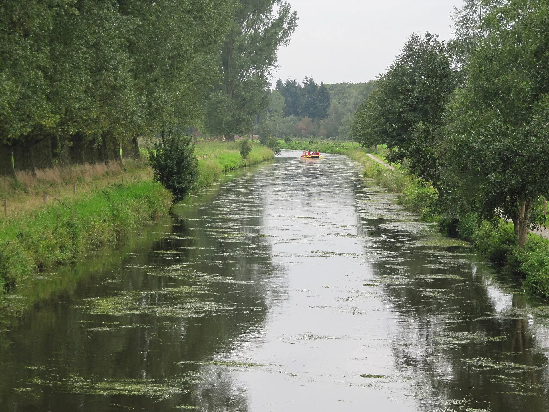
North of the town, the Nette flows into the Niers. Three nature reserves, canoe tours on the Niers and the Blaue Lagune bathing lake make the river landscape worth exploring.
Wachtendonk lies on the Lower Rhine plain, close to the Dutch border near Venlo. Two rivers shape the municipality: north of the town the Nette joins the Niers, which winds through the whole area.
No fewer than three nature reserves protect this landscape: Caenheide and the central Niers floodplain along the river, the Heronger Buschberge with the Wankumer Heide in the south-west, and the Vorster Feld. Footpaths and the remarkably quiet river scenery make them rewarding destinations.
On the water, the Niers is a popular spot for canoe and paddle tours — several rental stations and tour operators start in and around Wachtendonk. In the Wankum district, the Blaue Lagune bathing lake invites you to swim, complemented by a club-run natural outdoor pool on Wankumer Straße.
Wankum
The municipality's second locality: first mentioned as Wanchheim in 1279, part of Wachtendonk since 1969 — with heathland, a bathing lake and a living marksmen's tradition.
Wankum covers the south-western half of the municipality and was first mentioned as 'Wanchheim' in the charter of the Wankum Landfriede of 28 August 1279 — Franconian for 'home in the meadows and pastures'.
From 1798 to 1814 Wankum was under French rule and seat of its own mairie, which later became the Prussian Bürgermeisterei Wankum. Only on 1 July 1969 did the previously independent municipality become part of Wachtendonk.
Besides the village itself, the locality includes the hamlets of Aerbeck, Harzbeck, Langdorf, Müllem and Vorst. In the south-west lie the Wankumer Heide nature reserve and the Blaue Lagune bathing lake. Local tradition is carried by the United St. Johannes & St. Martini marksmen's brotherhood of 1532, and the Catholic parish church of St. Martin shapes the village scene. The Wankum junction connects the municipality to the A 40 motorway.
St Martin & tradition
Three St Martin's processions on three evenings — in Wachtendonk, Wankum and Harzbeck. The St Martin's tradition is one of the liveliest of the year.
Few customs shape November in Wachtendonk like St Martin's Day. The municipality holds three separate lantern processions — in the town of Wachtendonk, in Wankum and in Harzbeck — each on its own evening and run by the local St Martin's committee. The tradition is funded, as it has been for generations, by a door-to-door collection in October.
The procession in the town of Wachtendonk always takes place on 11 November. It sets off from the Schoelkensdyck schoolyard and winds its way, lanterns aglow, to the Friedensplatz, where the bonfire burns and the legend of Martin sharing his cloak is re-enacted. Afterwards the children receive their treat bags at the Michael primary school.
In Wankum the evening opens with a service in the parish church of St Martin; from there Saint Martin rides on horseback at the head of the procession, while a contest along the route rewards the finest house decorations. In Harzbeck the third procession closes with a celebration and an auction of the treat bags. One Wachtendonk speciality: it is not only children who receive a treat bag — every resident aged 75 and over is given a Weckmann, a sweet bread figure.
Wachtendonk in numbers
Demographics, land use and politics — from official open data.
Wachtendonk: age by sex (as of 31 Dec 2024).
Source: Regionalstatistik (Alter × Geschlecht) · tab. 12411-02-03-5
Wachtendonk compared
Wachtendonk compared with the municipalities in its district or the neighbouring towns — switch above. Tick areas — their values appear as coloured markers on the bars.
Tick areas — their values appear as coloured markers on the bars.
Structure
Source: Regionalstatistik
Land use (2015)
Economy
Education & family (per 10,000 pop.)
Source: OpenStreetMap · facility map
Health & retail (per 10,000 pop.)
Source: OpenStreetMap · facility map
Sport & leisure (per 10,000 pop.)
Source: OpenStreetMap · facility map
Tick areas — their values appear as coloured markers on the bars.
Political mood (federal election 23.02.2025)
Source: IT.NRW state database NRW
History in brief
- 12. Jh.Bailiffs of the Cologne archbishops build a moated castle on the 'Donk' — origin of the town's name.
- 1279Wankum is first mentioned as 'Wanchheim' in the Wankum Landfriede.
- 1326Wachtendonk becomes part of the Upper Quarter of the Duchy of Guelders.
- 1343Wachtendonk receives town rights and is fortified.
- 1468Battle of Straelen — Wachtendonk returns to the Duchy of Guelders.
- 1572–1600During the Eighty Years' War the fortress changes hands repeatedly between the Dutch and the Spanish.
- 1607The fortifications are razed.
- 1713In the Peace of Utrecht, Wachtendonk falls to Prussia.
- 1794French revolutionary troops occupy the left bank of the Rhine — twenty years of French rule.
- 1969Wankum becomes part of the municipality of Wachtendonk.
Did you know?
The name Wachtendonk comes from a 'Donk' — a sandy mound in the marshland on which the bailiffs of the Cologne archbishops built their moated castle.
The nearest big city isn't in Germany: Venlo in the Netherlands is just 13 kilometres away — Krefeld only follows at 20 kilometres.
In the 16th and 17th centuries, Wachtendonk was the militarily most important place in the Guelders Upper Quarter.
This small municipality holds three separate St Martin's processions — in Wachtendonk, Wankum and Harzbeck, each on its own evening.
The historic centre is a listed ensemble — around 120 protected monuments, and its street layout has barely changed since 1560.
The oldest house in the centre, Haus Püllen from 1634, today houses the tourist information and the nature park centre.
Now explore the city
Sources & links
- Wikipedia (retrieved 2026-07-03)
- Wikipedia (retrieved 2026-07-03)
- Wikidata (retrieved 2026-07-03)
- Official website (retrieved 2026-07-03)
- hso-nrw.de (retrieved 2026-07-03)
- niederrhein-tourismus.de (retrieved 2026-07-03)
- openstreetmap.org
How this page is made
This page draws on open sources — Wikipedia, Wikidata, official websites and the city’s open data. Every statement is checked against the sources linked here, and pages are refreshed regularly.
Spotted a mistake anyway? Tell us below — we read every submission.
Comments
- Loading comments…