Ringwall Greinberg
Celtic hillfort above the Main and Mud valleys, where the Romans later worshipped the god Mercury in two temples.
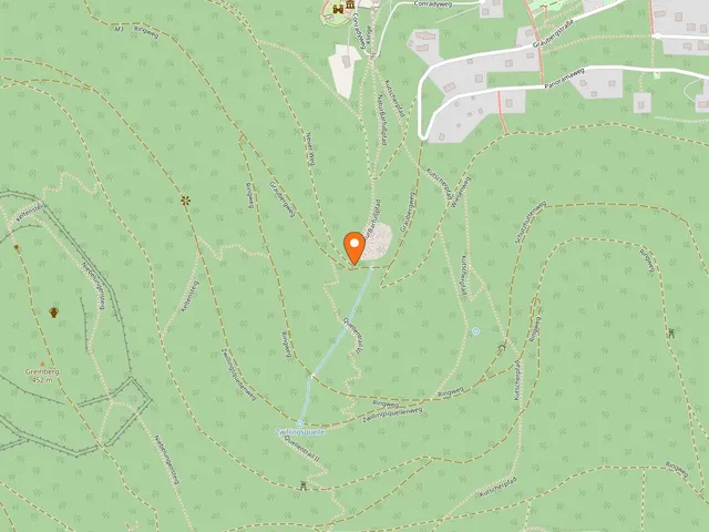
At around 430 m elevation, the Ringwall Greinberg is a prehistoric Celtic earthwork encircling the summit of the 452 m Greinberg. The site lies 1,100 meters from the town parish church of Miltenberg in the Bavarian district of Miltenberg.
At a Glance
- Type
- Remains of a Celtic ring-wall fortification, protected as an archaeological monument
- Location
- above the Main and Mud valleys, 1,100 m southwest of Miltenberg's town parish church
- Elevation
- wall at about 430 m, Greinberg summit at 452 m
- Extent
- inner wall spans roughly 1 km in circumference, enclosing 8.1 ha; the outer wall covers 15.5 ha
- Former names
- Ringwall Monbrunn, Römerschanze
- Special feature
- a Roman Mercury sanctuary lies within the enclosure
History
Iron Age inhabitants built the fortification on the strategically well-placed Greinberg. Its origins are thought to date back to the Urnfield period, and it continued to be used and expanded through the Hallstatt and La Tène periods. The archaeological site has yielded finds ranging from the Bronze Age to the Migration Period.
Layout and Ramparts
Oval in shape, the wall stretches along the mountain ridge toward the northwest. To the east, a more heavily eroded inner wall runs alongside the clearly visible outer wall. At the southern ridge approach, a ditch runs in front of the more massive wall there, which rises over 4 m on the outer side and about 2.50 m on the inner side. A nearly straight section of wall, 148 m long, has survived in the southwest. The exact locations of any gates cannot be determined with certainty.
Roman Era
With the advance of the Odenwald Limes and the establishment of the "wet" Main Limes, the area came under Roman rule. The Romans worshipped Mercury in two temples—one to the north and one within the Celtic enclosure—with the rectangular outline of the larger one still discernible at the center. Below the Greinberg to the southwest, a Roman roadside station has been identified. Finds from the site are held at the Museum Stadt Miltenberg.
Good to Know
About 150 m south of the ring-wall, the so-called Toutonenstein was discovered. An information board now marks the find site.
Gallery
Map
Blue dots: other places nearby — tap to explore.
Hours
So: 00:00–24:00
You might also like — related or nearby
Comments
- Loading comments…
Sources & links
- Official website
- Official website (retrieved 2026-07-18)
- Wikidata (retrieved 2026-07-13)
- Wikipedia (retrieved 2026-07-13, rev 259804753)
Auto-generated, last verified: 2026-07-13
How this page is made
This page draws on open sources — Wikipedia, Wikidata, official websites and the city’s open data. Every statement is checked against the sources linked here, and pages are refreshed regularly.
Spotted a mistake anyway? Tell us below — we read every submission.