Wachtendonk Castle
Ruins of a lowland castle on the Niers – the most important military stronghold in the Gelderland Upper Quarter during the 16th and 17th centuries.
On the left bank of the Niers, in a small patch of woodland at the southern edge of the Lower Rhine municipality of Wachtendonk, the remains of a lowland castle have survived. Its history is closely tied to the fortress town of Wachtendonk, long contested along the eastern border of the Duchy of Gelderland.
At a glance
- Type
- ruins of a lowland castle
- Location
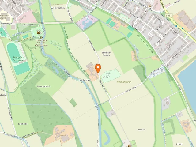
- left bank of the Niers, woodland at the southern edge of Wachtendonk
- Early evidence
- recovered timbers dated to 1252 and 1257 – suggesting the settlement and castle predate their first documentary mention in 1326
- Significance
- the most important military site in the Gelderland Upper Quarter during the 16th and 17th centuries
- Notable feature
- in the 14th century it guarded an important Niers crossing
- Access
- freely accessible
Origins and name
From the 9th century the surrounding area was known as Geisseren and belonged to Electoral Cologne. On a rise called Donk amid the marshy Niers lowlands, the bailiffs of the Archbishop of Cologne built an early fortification known as Vogtendonk. From this the name Wachtendonk evolved, passing first to the settlement and later to the castle's owners. An Arnold von Wachtendonk is first recorded in 1196; a fortified house with a mill and fortified settlement appears in the sources in 1326. Already in the 14th century the castle stood at a key crossing point over the Niers.
Between Gelderland, Cologne, and Kleve
Wachtendonk was a fief of Gelderland, with Electoral Cologne territory beginning on the opposite bank of the Niers. Through skillful maneuvering, the Lords of Wachtendonk long preserved their independence: in 1390 Arnold IV confirmed his fief status to Gelderland, yet in the same year declared his castle an open house to Archbishop Friedrich III of Saarwerden of Cologne, provided it was not used against Gelderland. Duke Rainald IV of Gelderland seized the castle by force in 1407 and turned it into an administrative district (Amt), with Goswin Spede von Langenfeld as its first Gelderland bailiff. Johanna, heiress of Arnold IV, married Wilhelm von Jülich, illegitimate son of Rainald IV, who received the castle as a wedding gift. In 1434 Wilhelm and his wife sold castle, town, and land to Duke Arnold of Egmond. Shortly afterward, troops from Berg and Cologne seized the castle; since Wilhelm had not yet vacated it, he lost numerous valuable possessions. In 1440 Gelderland pawned the estate to Kleve, and in 1473 it passed to Kleve permanently.
Sieges and reconstruction
An inventory from 1463 lists numerous rooms, including a chapel, hall, kitchen, wine cellar, and brewhouse. By around 1470 the castle had fallen into serious disrepair; 100,000 bricks were needed for its restoration. In 1503 Otto Schenk von Nideggen captured the town of Wachtendonk; the castle itself fell only in 1504, after a siege lasting from September 1503 to Easter 1504, taken on behalf of Charles of Gelderland. A fire caused severe damage during the assault. The subsequent rebuilding produced a massive round tower and an east wing. A 1517 agreement guaranteed Otto the district as long as the duke had not repaid the 17,000 Rhenish guilders spent on reconstruction.
The Eighty Years' War
After Gelderland was united with the Duchy of Kleve in 1538 and ceded to Burgundy under the 1543 Treaty of Venlo, Emperor Charles V, as Duke of Gelderland, sold the town, castle, and lordship to Godart von Bocholtz in 1547, who adapted the fortifications to modern firearms. Nevertheless, the castle was briefly occupied by troops of William of Orange in 1572, and from 1578 for an extended period by the Dutch States General. In 1588 Spanish troops under Peter Ernst I of Mansfeld besieged the site for three months, bombarded it, and captured it; Arnold Huyn von Amstenrade was then appointed governor of castle and town. A depiction from that year shows the castle as three groups of buildings on an island in the Niers. During a further conquest in 1603 it was likely damaged so severely that it was never rebuilt.
Today
Excavations in the 1960s uncovered the foundations and partially rebuilt the walls. The ruins remain freely accessible at all times.
Gallery
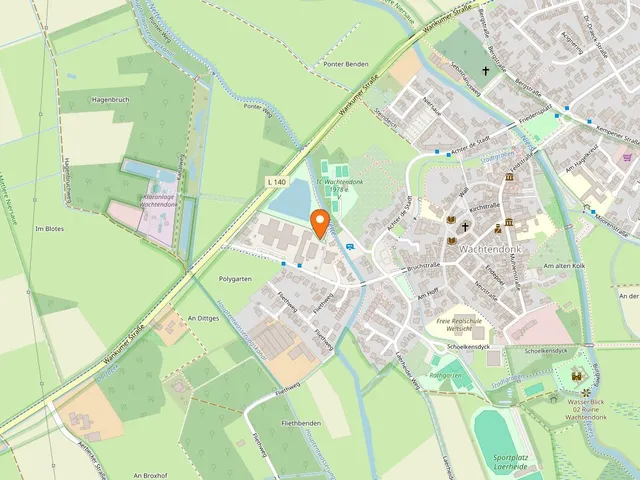
Map
Blue dots: other places nearby — tap to explore.
You might also like — related or nearby
Comments
- Loading comments…
Sources & links
Auto-generated, last verified: 2026-07-03
How this page is made
This page draws on open sources — Wikipedia, Wikidata, official websites and the city’s open data. Every statement is checked against the sources linked here, and pages are refreshed regularly.
Spotted a mistake anyway? Tell us below — we read every submission.