Miltenberg-Altstadt Fort
Roman cohort fort at the junction of the Main Limes and the 'Vorderer Limes' – the southernmost site on the 'Wet Limes' and part of the UNESCO World Heritage Site.
At the junction between the Main Limes and the 'Vorderer Limes', Roman soldiers guarded the empire's frontier from this cohort fort. The section today belongs to the UNESCO World Heritage Site 'Upper German-Raetian Limes'.
Source: Wikipedia
At a Glance
- Type
- Roman cohort fort of the Principate
- Location
- 'In der Altstadt' field, about two kilometres northwest of Miltenberg's medieval town centre in Bavaria
- Province
- Germania superior
- Founded
- Around 159/160 AD
- Construction phases
- Initially a timber-and-earth fort, later rebuilt in stone
- Distinctive feature
- Simultaneously the southernmost site on the 'Wet Limes' and the northernmost fort of the 'Vorderer Limes'
Things to do here
Location and Surroundings
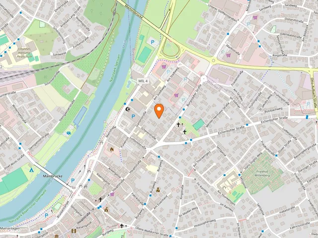
Large parts of the site were never built over, so it still stands out as a distinct rise in the ground. It lies northwest of where the Mud stream flows into the Main. The Main's floodplain reaches right up to the fort's river-facing praetorial front; in antiquity, both the Mud and the Springbornbach, which flows out to the northeast, formed marshy river mouths. The soldiers drew their water from the Springbornbach. On the river side, the medieval town wall rests on the foundations of the Roman enclosure, and the Altstadtweg path enters the site exactly where the Porta principalis dextra once stood as the southeastern gate. A railway line still runs through the rear camp, the retentura, to this day.
Origin of the Field Name
The name 'In der Altstadt' derives from the later-abandoned medieval settlement of 'Wallhausen', which was established on the fort's grounds. Its name evidently still referred to the ramparts of the former Roman garrison.
Research History
In 1827, chronicler Michael Josef Wirth came across two Roman altar fragments, though the fort itself was not yet known; they named the Cohors Sequanorum et Rauracorum equitata. Philipp Joseph Madler identified the site as a Roman installation and published his findings in 1842; his excavations in the 1830s uncovered further inscriptions. Both the altar fragments and these inscriptions have since been lost. Railway construction cut through part of the site in 1875 and struck the fort's bathhouse in 1878, whose finds were recovered by operations engineer Max Scherer, who also drew up a floor plan of the baths. From 1878 to 1892, Wilhelm Conrady conducted research on behalf of the Reich Limes Commission. The fort's interior remained unexplored for a long time because a vineyard prevented any investigation. The major excavations from 1970 to 1976 under prehistorian Bernhard Beckmann were funded by the German Research Foundation with support from the Bavarian State Office for the Preservation of Historical Monuments; the town of Miltenberg later carried out smaller excavations, and from 1988 to 1990 Ludwig Wamser worked at the Altstadt fort.
Building History
The fort was established with the shift of the frontier to the 'Vorderer Limes' under Emperor Antoninus Pius, archaeologically dated to around 159/160 AD. The accompanying relocation of garrisons to the new forts affected all military sites along the Neckar-Odenwald Limes and represented a considerable organisational achievement. Almost simultaneously, the fort at Miltenberg-Ost was built roughly 2,300 metres to the southeast; the presence of two forts on the same bank of the Main underscores the strategic importance of this frontier section. From here, the military and trade road led out of the Main valley towards the Rhine and Neckar, and a boat landing was likely built on the nearby Main for transporting goods and building material. The only archaeological terminus post quem so far are Sigillata wares from Rheinzabern, whose production began around 130–140 AD.
From Timber Fort to Stone Fort
The fort was first built in timber-and-earth construction. About one metre behind the later stone wall, excavators uncovered a box-shaped foundation trench roughly two metres wide and almost a metre deep. Along its long edges, larger post holes appeared at regular intervals of 3.20 metres, with smaller trenches in between that once held closely set upright timbers – together forming an earth-filled timber box construction, likely supported on both sides by a sloped turf rampart. The early fort had a wide berm with probably just a single V-shaped ditch. From the lowest layer of the founding phase came an enamelled plate brooch with a hinged pin, which Beckmann cautiously dated to around the middle of the first half of the 2nd century. The later rebuilding in stone can only be dated, in the absence of inscriptions, via a partially preserved building inscription from the Miltenberg-Ost fort, which points to the reign of Septimius Severus (193–211) and names his son Caracalla.
Preservation and Today
The foundations lie in many places beneath agricultural land and have only been disturbed in modern times within the praetentura, the front camp; all other changes date from medieval building over the site. Information panels mark the Porta principalis sinistra, the site of the Porta principalis dextra, and the location of the baths. The military bathhouse, a few metres to the southeast, has been preserved underground. An associated vicus is documented but is not visible at the surface.
Map
Blue dots: other places nearby — tap to explore.
You might also like — related or nearby
Comments
- Loading comments…
Sources & links
Auto-generated, last verified: 2026-07-13
How this page is made
This page draws on open sources — Wikipedia, Wikidata, official websites and the city’s open data. Every statement is checked against the sources linked here, and pages are refreshed regularly.
Spotted a mistake anyway? Tell us below — we read every submission.